Cliff Collapses at Portugal's Beaches in 2026: Where It's Dangerous and How to Stay Safe
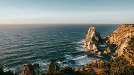
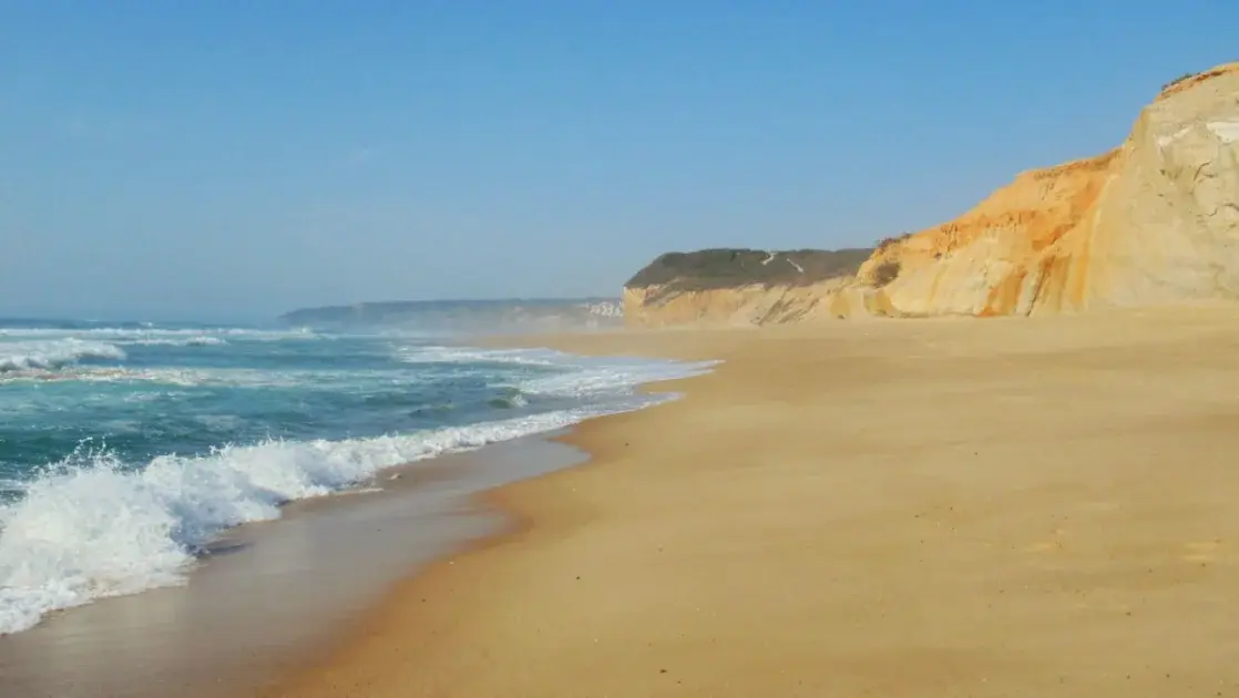
Golden sandstone cliffs plunging into a turquoise Atlantic are one of the most photographed images of a Portuguese holiday, especially along the Algarve and the Costa Vicentina. It's also a real, underappreciated safety topic. In 2026, Portugal's Environment Agency (APA) declared intervention on the country's coastal cliffs a "super urgent" national priority, after a series of collapses affected both beaches and residential areas along the coast, from Costa da Caparica near Lisbon to the Algarve.
This guide uses official 2026 data and documented real-world cases to explain where cliff-collapse risk is highest in Portugal, the official safe distance recommended by authorities, how to spot warning signs on the ground, and what to do if the beach you're planning to visit has hazard signage. This isn't a reason to avoid Portugal's cliff beaches — it's the same kind of practical safety knowledge you'd want for rip currents or red flags, applied to the cliffs above the sand.
Why Portugal's Coastal Cliffs Are Unstable
Portugal's coastal cliffs (called "arribas" in Portuguese) are made of layered sedimentary rock — sandstone, clay, limestone — laid down over millions of years and continuously carved by sea and rain. That same erosion is what creates the caves, arches and golden formations that make beaches like Praia da Marinha or Benagil famous worldwide. But the process that sculpts the landscape also destabilizes it: rainwater seeps into the softer inner layers, the sea undercuts the base during storms and spring tides, and summer heat can dry out and crack the upper layers, making them more prone to breaking off without warning.
According to APA, the winters of 2025 and 2026 were unusually wet, accelerating cliff degradation along several stretches of coast. In February 2026, Costa da Caparica, just south of Lisbon, suffered three separate landslides on the same stretch of coastline within a few weeks, forcing the evacuation of dozens of homes near São João da Caparica. APA's president publicly acknowledged that safe beach access could not be guaranteed there in the short term, nor could the cliff be stabilized quickly. Portugal's Environment Minister called cliff stabilization nationwide a "super urgent" government priority, with damage estimated at roughly €27 million along the coast.
Where the Risk Is Highest in 2026: A Regional Overview
Cliff-collapse risk isn't spread evenly across Portugal — it's concentrated on stretches of rocky, sandstone coastline rather than long open sand beaches. The table below summarizes what was reported in 2026 across the main affected areas.
| Region | 2026 status |
|---|---|
| Algarve (Albufeira, Lagos, Carvoeiro/Lagoa) | At least 75 beaches carry cliff-collapse warning signage; Albufeira has the most affected beaches (24). Access to Praia do Camilo in Lagos was restricted after winter rain damaged the wooden stairway down to the sand. |
| Costa da Caparica / Almada (near Lisbon) | Three landslides recorded since February 2026 on the same stretch; dozens of homes evacuated near São João da Caparica; APA says it cannot guarantee safe beach access there in the short term. |
| Alentejo Coast / Costa Vicentina | An APA report (March 2026) identified damage at 28 beaches along the Alentejo coastline, prompting extra inspections and signage ahead of the summer season. |
| Peniche / Baleal | A dedicated municipal program ("safer beaches and cliffs") added signage and physical barriers in the busiest tourist and surf areas. |
None of this means these beaches are closed outright — the overwhelming majority remain open and welcome visitors as usual. It means specific zones, near the base or edge of the cliffs, need to be treated with real caution and respected when marked.
The Official Safe Distance: 1.5 Times the Cliff's Height
APA's cliff risk zone program defines a simple rule anyone can apply without technical training: the "risk strip" — the area where debris from a potential collapse could land — has a width equal to 1.5 times the height of the cliff. For a 20-meter cliff, that's a 30-meter buffer from the base. Portuguese law (Decree-Law 159/2012) requires beachgoers to stay clear of zones marked as hazardous, and the National Maritime Authority's 2026 beach regulations explicitly ban crossing protective barriers or ignoring safety-related signage.
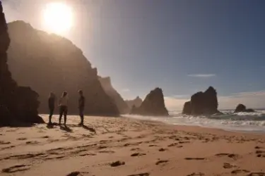
In practice, this means never setting up an umbrella, having a picnic, or sitting directly against the base of a cliff — even if it looks solid and even if other people are doing it. The technical survey behind each warning sign is carried out by APA before the start of the summer season, specifically to flag these risk points case by case.
How to Spot Warning Signs on the Ground
Official Signage
Stakes, tape, information panels, or physical fencing near a cliff aren't there for show — they follow a technical survey by APA or the local municipality. If you see warning signage, the advice is simple: don't ignore it, even if the path down still looks passable.
Visual Warning Signs
Fresh cracks in the rock face, visible loose boulders, piles of soil or sand at the base (a sign of a recent fall), dark damp staining on the rock (water infiltration), and vegetation that's tilted or pulling away from the slope are all signs of instability that any visitor can spot without any technical training.
Conditions That Increase Risk
Risk clearly rises in the days and weeks after heavy rain, once water has soaked into the cliff's inner layers. But contrary to what many visitors assume, the risk doesn't disappear in the dry summer months: extreme heat can dry out and crack the surface layers, making them more fragile. Prolonged heatwaves, like the one recorded in Portugal in July 2026, are often followed by an increase in small rockfalls.
What to Do If a Beach Has Hazard Signage
- Always respect signage and barriers, even if they seem excessive — they follow a real technical assessment, not blanket caution.
- Never sit, lie down, or set up gear directly against the base of a cliff, even in an area with no visible signage — it's the single behavior most associated with serious accidents.
- Avoid climbing to the top of a cliff for photos, especially near the edge — erosion can weaken the ground with no visible surface warning.
- If you hear rocks or soil falling, move away immediately perpendicular to the cliff (never running along the base), never parallel to it.
- Check for updated access information before visiting cliff-access beaches like Praia do Camilo in Lagos, especially after periods of heavy rain.
- If your planned beach has restricted access, choose an alternative nearby beach rather than going around barriers — the regularly updated list of beaches closed to swimming in Portugal in 2026 is a good starting point.
A Real Case: The Praia Maria Luísa Tragedy
On August 21, 2009, a rock roughly 10 meters tall and 6 meters wide broke away from the cliff face above Praia Maria Luísa in Albufeira, killing five people — four from the same family — and seriously injuring two others. A technical assessment carried out before that summer season had not detected signs of imminent collapse at that specific spot, although another section of the same beach was signposted. The case went to court, and more than a decade later, the Portuguese state was ordered to pay over €1 million in compensation to the victims' families over failures in the duty to warn.
It remains the deadliest cliff-collapse accident recorded at a Portuguese beach, and it's frequently cited by APA and coastal municipalities as the reason behind the annual technical surveys and expanded signage that now cover nearly all of Portugal's rocky coastline.
Frequently Asked Questions
What is the recommended safe distance from a cliff at a Portuguese beach? APA defines the "risk strip" as 1.5 times the height of the cliff, measured from the base. For a 20-meter cliff, you should stay at least 30 meters away, both at the base and near the top edge.
Is it true that 75 Algarve beaches have cliff-collapse warning signage in 2026? Yes. According to data reported by Portugal's Environment Agency (APA) in 2026, at least 75 Algarve beaches carry cliff-collapse risk signage, with Albufeira accounting for the most (24 beaches).
Are beaches with cliff-hazard signage closed to the public? In most cases, no — they remain open, but with specific zones near the cliffs marked off-limits. Only in more serious situations, like parts of Costa da Caparica in 2026, is access fully restricted.
Does cliff-collapse risk only exist after heavy rain? No. Risk rises in the days following intense rain, but it can also increase during the dry summer, when extreme heat cracks the cliff's surface layers, causing small rockfalls even without recent rainfall.
Have there been deaths from cliff collapses at Portuguese beaches? Yes. The deadliest case occurred on August 21, 2009, at Praia Maria Luísa in Albufeira, where a falling rock killed five people. The Portuguese state was later ordered to compensate the victims' families.
Conclusion
The cliffs are part of what makes Portugal's coastline so photogenic — but in 2026, with dozens of beaches flagged between the Algarve, the Lisbon area, and the Alentejo, it's worth treating cliff-collapse warning signs with the same respect you'd give a red flag in the water. The rule is easy to remember: stay back a distance equal to 1.5 times the cliff's height, never set up right against the base or the top edge, and always respect barriers and warnings, even on a calm, sunny day. To finish planning a safe beach day, check out our guide to beach safety, flags and currents, the updated list of beaches closed to swimming in 2026, our summary of Portuguese beach rules and fines, and our complete guide to Praia da Marinha, one of the Algarve's most visited cliff beaches.